Day 4 · Agrigento Coast
Lounge Beach Scala dei Turchi
Step 1 · Before you enter · ~15 sec

Lounge Beach Scala dei Turchi

★ 4.1 (3,480) €25 Maps ↗ Website ↗

It isn’t a staircase at all, but a 5-to-2-million-year-old marl cliff that the sea has worried into terraces, which is exactly why it fools the eye and rewards a slow look. The real test is whether you notice how much history gets smuggled into a beach by a piece of weathered rock.

Stand outside · play the audio first, then read on.

Step 2 · The story · ~2 min

Why this place matters

Scala dei Turchi matters because its fame was built as much by conflict as by scenery. Local tradition says the white marl steps at Punta Grande were used by Ottoman and Saracen raiders as a sheltered landing place in the 1500s, when the coast was exposed and the cove offered easier access than the open shore.[6][12] That older story still hangs over the place: it is not just a place to swim, but a shoreline whose name remembers who came ashore here and why.[6][12]

The modern turning point came in 2020, when prosecutors seized control of the site amid a long dispute between the municipality of Realmonte and a local landowner, Ferdinando Sciabbarrà.[8][10] Then, in January 2022, vandals smeared the cliffs red, and the cleanup that followed made the place look, for a moment, like a crime scene washed in chalk and water.[8][13] Since then, access has been tightened with wooden barriers and pedestrian-only entry in part of the area, a small but visible sign that this is a landscape people now have to protect as carefully as they admire it.[7]

Read more →
Step 3 · Going in

Here's how

Best time to visit

Go early or late. By afternoon the white marl throws a harsher glow, and the beach is usually less punishing once the crowds thin out.

Entry strategy

Treat it as a beach stop, not a ticketed attraction. Plan for parking and the short walk from Punta Grande, and do not expect access onto the cliff itself because it is fenced off.

Recommended route

Use the sandy Punta Grande beach as your base, then work the shoreline for the best angle on the cliff. Swim first, then return for the low-sun photo from the sand rather than trying to approach the marl.

Tap ⓘ at the top right anytime for hours, address, prices.

Look at this · 1 of 5
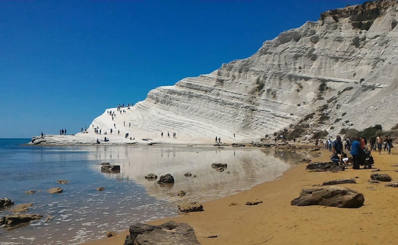
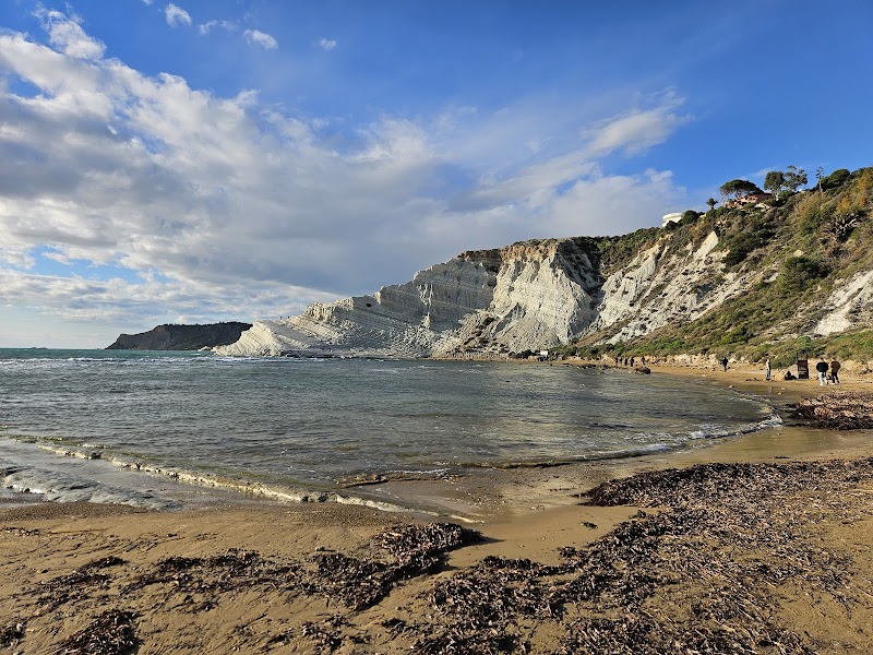
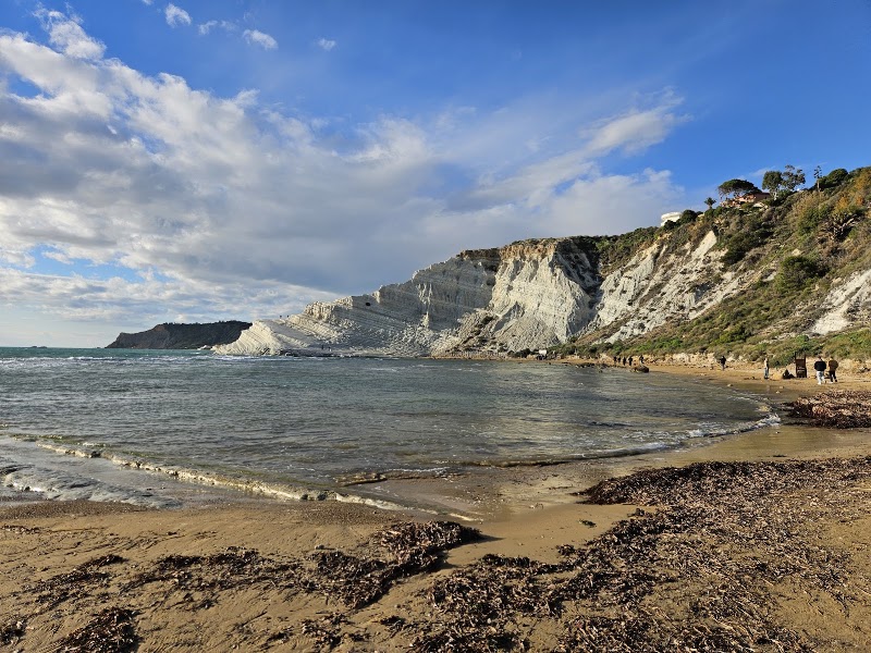
White wall from Punta Grande sand

White wall from Punta Grande sand

Where to find itStand on the sandy stretch of Punta Grande beach and face the cliff directly from the waterline.

Look forA blunt white marl face dropping straight to the beach, with no path actually running up it.

Why it matters · This is the whole trick of the place: the cliff is the backdrop, not the route. If you picture it as a place to climb, you miss the real experience, which is the contrast between a protected cliff and an ordinary swim beach below it.
Look at this · 2 of 5
Afternoon glow on marl

Afternoon glow on marl

Where to find itLook back at the cliff from the beach in the later afternoon, especially when the sun is low.

Look forThe white surface turning almost blinding, with hard shadows picking out the stepped folds and edges.

Why it matters · The cliff changes character with the light; in strong sun it can look flat, but late day gives it shape and drama. That is the moment for the trip’s best photo, and it is easy to miss if you arrive too early.
Look at this · 3 of 5
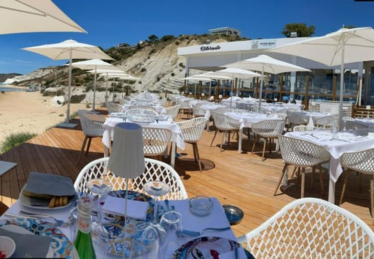
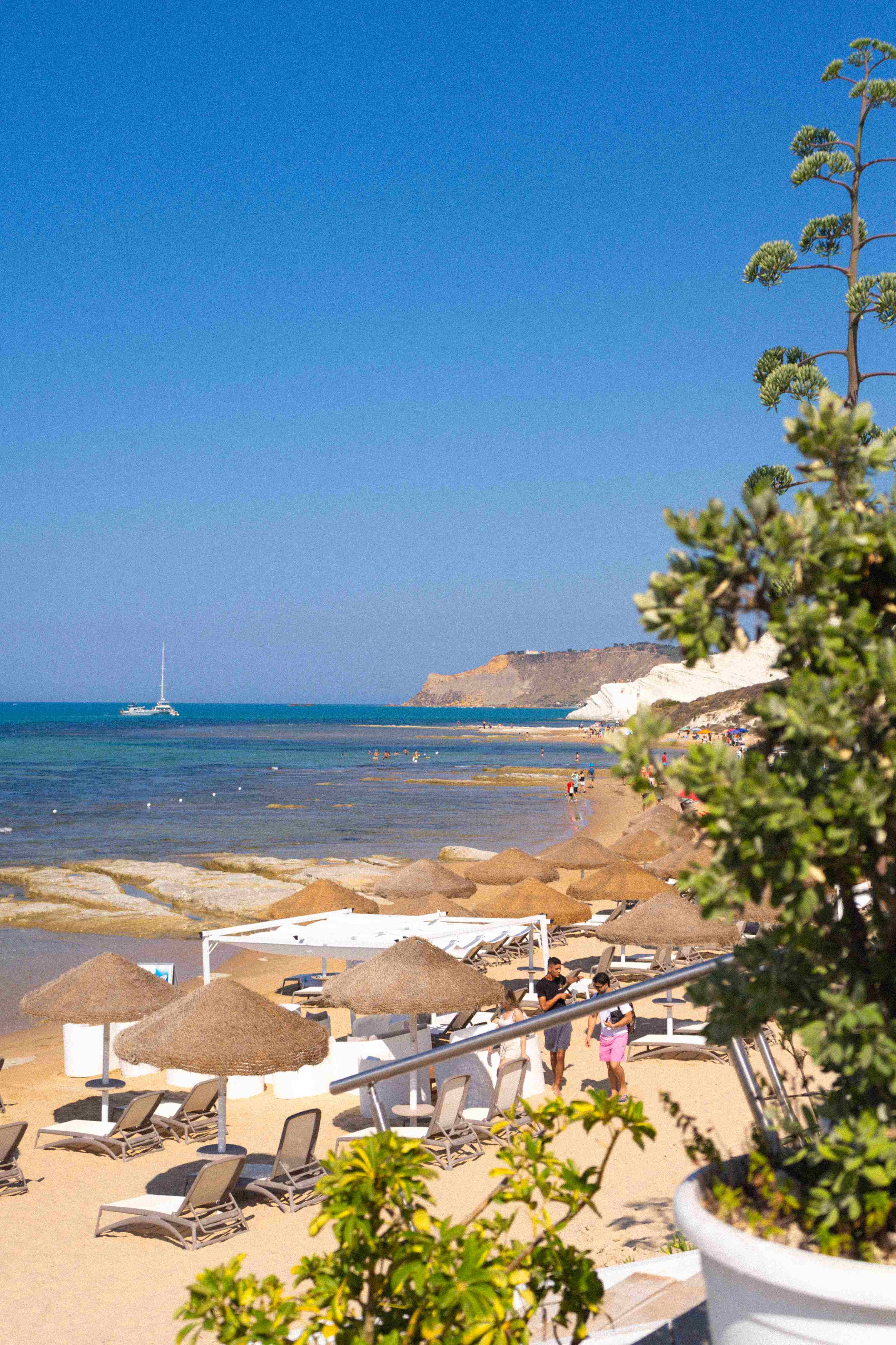
Free strip beside the lido

Free strip beside the lido

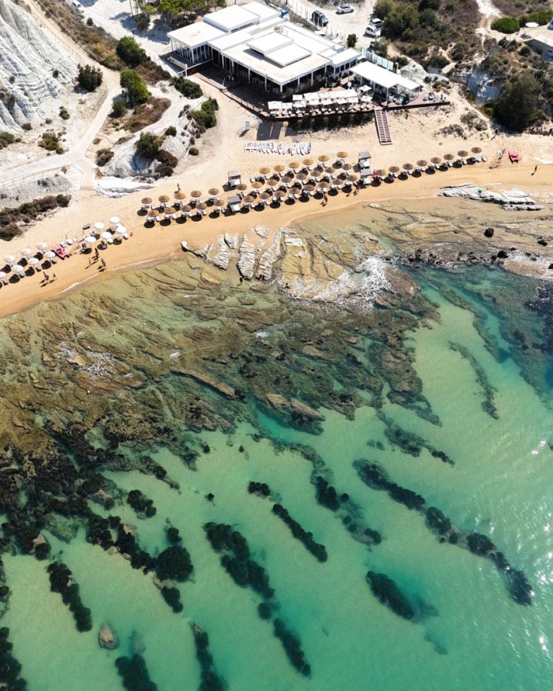
Where to find itWalk the beach edge beside the organized lounger area and find the open sand section.

Look forA plain free-access strip with towels and umbrellas, versus the denser rows of paid loungers.

Why it matters · Families often assume the whole beach is privatized, but there is usually a usable public stretch. Knowing where the free section starts saves time, money, and a fruitless search for the one empty umbrella gap.
Look at this · 4 of 5
Rocky bottom near shore

Rocky bottom near shore

Where to find itEnter the water slowly near the swash zone and test each step before committing to a swim.

Look forPatchy stones and uneven bottom texture under clear water, especially close to shore.

Why it matters · This is why water shoes matter here. Without them, a straightforward beach swim can turn into a stingy, awkward walk that nobody remembers fondly.
Look at this · 5 of 5
Protected cliff boundary

Protected cliff boundary

Where to find itLook for the fence line and any posted no-entry signs at the base and lower approaches to the marl.

Look forA clear barrier that separates the beach from the cliff itself.

Why it matters · The cliff is off-limits for a reason, and the barrier is not decorative. Spotting it early keeps the day simple: swim, photograph, and stay off the fragile surface.
Photo gallery

What it looks like

Almost done · before you leave

Spot these

Find each one — tap to tick it off.

Done · time to eat

Nearby eat & drink

Filters

Section
Price
Max walking time
Minimum rating
Type

Quick grab

Fast food & takeaway for when you just need something fast

  • Kiross Street Food Parkingland Scala dei Turchi

    16 min walk
    ★ 4.8 (481) Fast Food Restaurant
  • Chiosco Belvedere Il Giardino della Scala Nuova gestione.

    18 min walk
    ★ 4.1 (97) €€ Bar

Searched, none found within range: Specialty coffee · Coffee & bakery · Lunch · Dinner · Familiar chains / fast food. The nearest fast food is likely in the closest town.

Practical info

GPS 37.2755, 13.4735
Typical duration (min) 90

More about this place

Scala dei Turchi is not a man-made monument at all, which is precisely why it keeps getting pulled into architectural conversations: it is a Pliocene marl formation, part of the Trubi succession, built from marine microfossils laid down between about 5.3 and 2.5 million years ago, then lifted and sculpted by wind, rain, and surf into those broad, step-like terraces[3][6][12]. The comparison that matters is not with a neighboring beach but with a geological section: Punta di Maiata is treated by geoscientists as a reference sequence for the Pliocene, with the Messinian-Zanclean boundary visible in the strata, so the place functions less like scenery than like a readable archive of Mediterranean history[6]. Its whiteness comes from marl, a soft clay-limestone rock, and that softness explains the carved edges and shallow ledges better than any romantic legend does[3][11][15].

The name, though, belongs to history as much as geology. Local tradition ties “Scala dei Turchi” to Saracen and Barbary pirate raids in the 16th century, when Ottoman-affiliated raiders—called “Turks” in local usage—used the sheltered cove as a landing point along the Sicilian coast[1][8][13]. That story places the site inside the wider politics of Mediterranean frontier warfare, when coastal settlements from this stretch of Sicily lived with intermittent plunder and lookout culture rather than leisure travel[2][8]. There is no architect to name here, and that absence is the point: Scala dei Turchi belongs to the category of natural forms that later acquire cultural meaning, the way a quarry face or a cliff can become a civic emblem without ever passing through a drawing board[1][3].

Sources: