Day 10 · Loire Valley
Conche of Whales
Step 1 · Before you enter · ~15 sec

Conche of Whales

★ 4.6 (930) Maps ↗

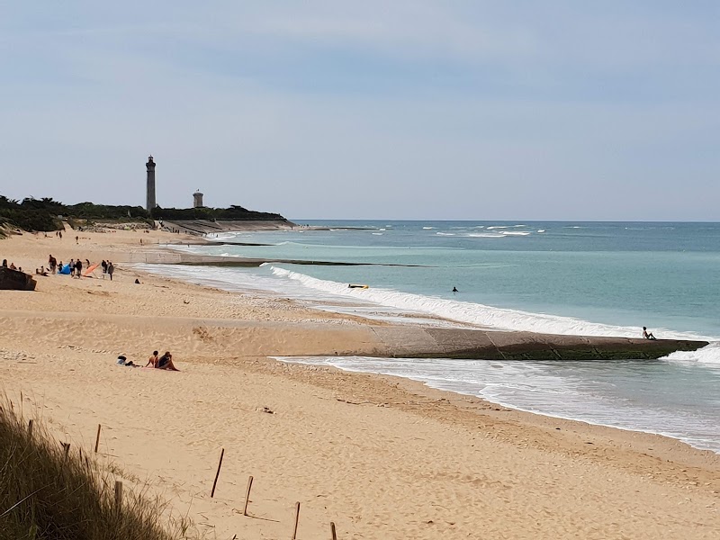
You’re standing at the edge of a beach that keeps changing as you walk it. Up by the lighthouse, the ground is rougher; a little farther on, the sand opens wide and soft.

Stand outside · play the audio first, then read on.

Step 2 · The story · ~2 min

Why this place matters

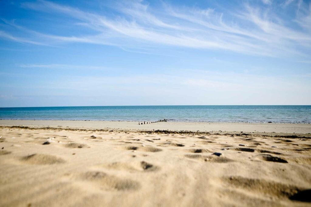
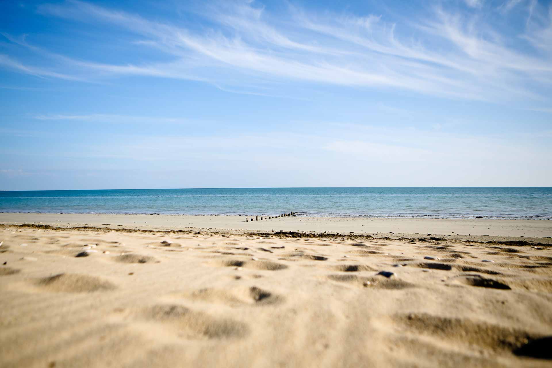
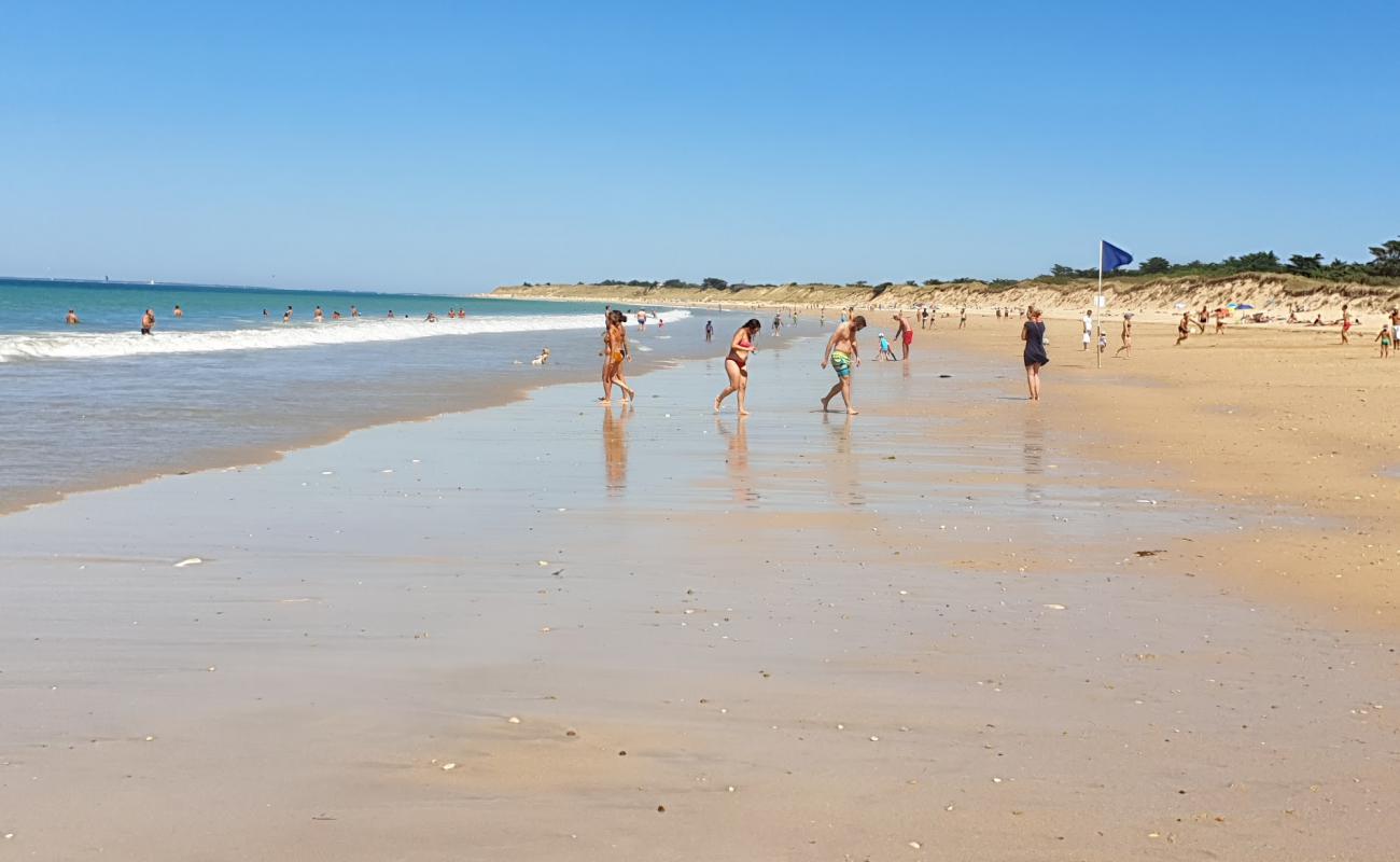
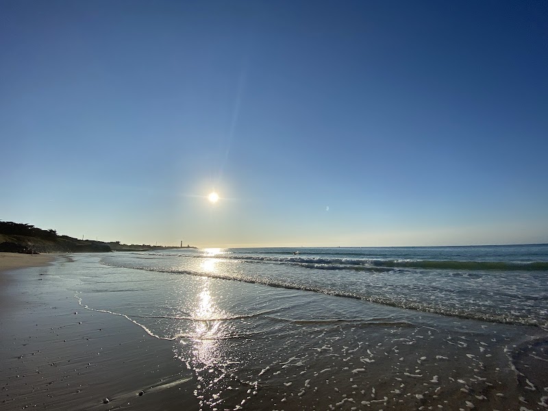
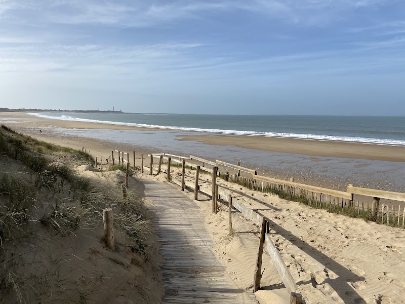
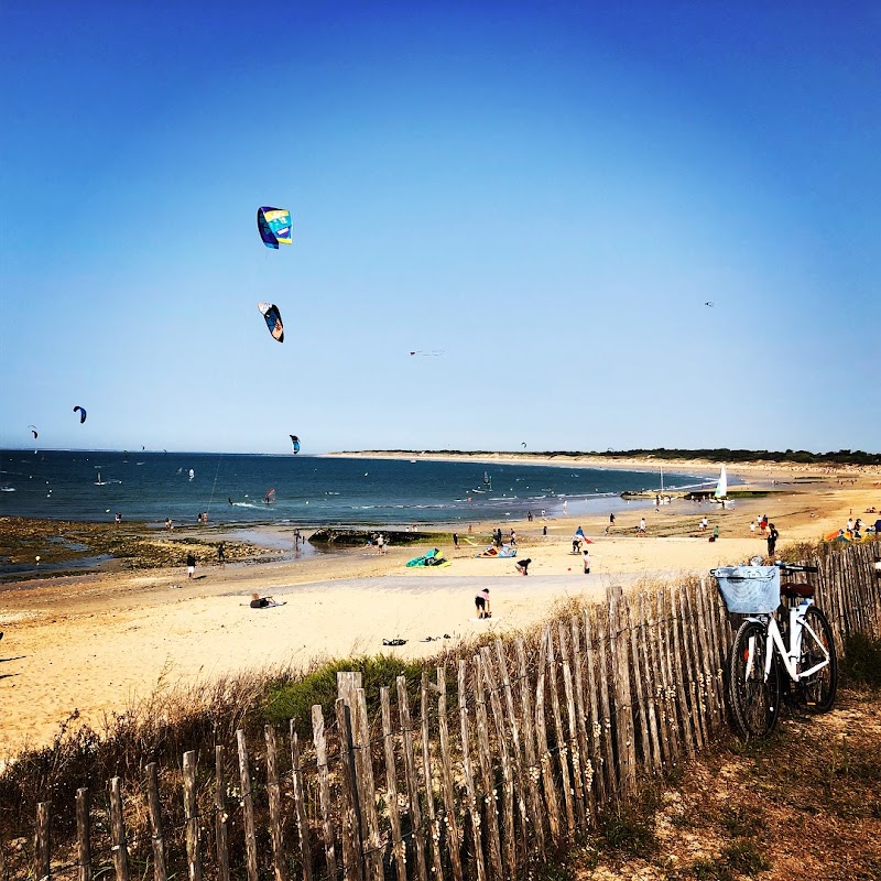
This is Plage de la Conche des Baleines, a long Atlantic beach that runs for almost three kilometers from the Phare des Baleines toward Les Portes-en-Ré. It matters because this shoreline still works when the tide is low, so you can swim, walk, and spread out without feeling boxed in. If you look west near the lighthouse, you’ll notice the rockier edge; then, as you move east, the beach turns broader and gentler, with dunes and the Lizay forest behind you. In summer, people come here for supervised swimming, but it is also a simple place to just breathe, watch the water, and let the day slow down. For one small detail, look for how the beach curves away beside the lighthouse, like a long pale ribbon pulled along the ocean before you head home from here.

Read more →
Step 3 · Going in

Here's how

Best time to visit

Go earlier in the day or late afternoon if you want easier parking and fewer people. In summer, the supervised bathing sector runs from 11:00 to 19:00, so arriving within that window is the simplest choice for a swim.

Entry strategy

There is no ticketed entry; the beach is free. Use the main access near the D101 and the paid parking area so you land close to the supervised stretch and avoid wandering in from the wrong end.

Recommended route

Start by the lighthouse-side rockier edge, then work east toward the broader sand and bathing zone. If you are ending the day here, do a short swim, a walk along the waterline, and leave from the same main access rather than crossing the full length of the beach.

Tap ⓘ at the top right anytime for hours, address, prices.

Look at this · 1 of 5
Rocky west end

Rocky west end

Where to find itStand near the base of the Phare des Baleines and look left along the waterline at the western end of the beach.

Look forA rougher strip of shore with rocks and tighter sand than the open beach farther east.

Why it matters · This end is the beach’s harder edge, and it is easy to miss if you walk straight to the middle. It shows how the Conche changes from a rougher lighthouse-side margin to the broad bathing beach people usually notice.
Look at this · 2 of 5

Main bathing stretch

Where to find itHead to the access near the D101 and the paid parking area, then step onto the sand a little before the Maison des dunes.

Look forA broad, softer span of fine sand with the supervised bathing zone in summer.

Why it matters · This is the part most people actually use for swimming, not just passing through. It is the easiest place to settle for a last beach stop because it is wide, familiar, and set up close to parking.
Look at this · 3 of 5
Dune-and-forest edge

Dune-and-forest edge

Where to find itWalk to the back of the beach and face inland toward the dune line and the forest of the Lizay.

Look forA clean border of dunes backed by dark pines instead of buildings or a promenade.

Why it matters · That edge explains why the beach still feels open and wild rather than built-up. Without noticing it, you miss the landscape that frames the whole Conche.
Look at this · 4 of 5
Low-tide usable shoreline

Low-tide usable shoreline

Where to find itCheck the whole beach line at the water’s edge, especially if the tide is dropping.

Look forA long, exposed sweep of sand that still leaves room to walk and swim when the sea is out.

Why it matters · This beach stays useful at low tide, which is not true of many Atlantic beaches. That makes it especially practical for a late-day swim-plus-walk before heading home.
Look at this · 5 of 5
Eastward softening

Eastward softening

Where to find itFollow the sand east away from the lighthouse until the ground looks smoother and broader.

Look forThe beach becoming more uniformly sandy and less rocky as you move toward the Portes-en-Ré side.

Why it matters · Most visitors stop near the lighthouse and never notice that the beach gets friendlier for lounging and bathing farther east. The shift is the point: it tells you where to position yourselves for the softest, most comfortable stretch.
Photo gallery

What it looks like

Almost done · before you leave

Spot these

Find each one — tap to tick it off.

Done · time to eat

Nearby eat & drink

Filters

Section
Price
Max walking time
Minimum rating
Type

Lunch

Sit-down lunch spots

Dinner

Where to land in the evening

Quick grab

Fast food & takeaway for when you just need something fast
Searched, none found within range: Specialty coffee · Coffee & bakery · Familiar chains / fast food. The nearest fast food is likely in the closest town.

Practical info

Address Conche of Whales, France
Time 16:30
Suggested 90 min
Rating 4.6★ (930)
Map Open in Google Maps

More about this place

Look for the rockier west end by the lighthouse and the dune-and-forest edge behind the sand; most people just spread out and miss how the beach changes from rougher ground near the Phare des Baleines to a much softer, broader swimming zone farther east.[2][6] Go earlier in the day or late afternoon if you want easier parking and fewer crowds, and use the main access near the D101/paid parking area so you land close to the supervised bathing stretch in summer.[1][2][6] What makes this beach matter is that its long, exposed shape still works at low tide, so it stays useful for swimming and walking when many Atlantic beaches feel cut off.[2] For Claudiu, Roxana, and Melek, it is a good last beach stop: free, wide enough to avoid feeling cramped, and easy to turn into a short swim-plus-walk before heading home without adding a long detour.[1][4]